Geography circles around Earth's artificial landscapes. Thu 23 March 2023
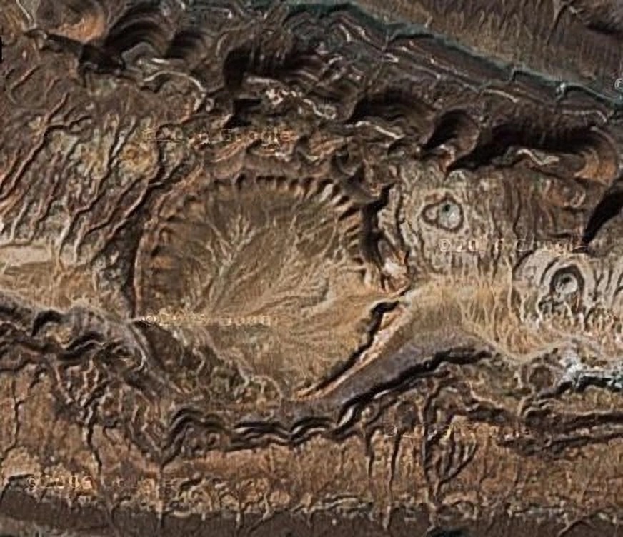
Ourkziz is where the arcs is. Source: Impact Craters Africa
See the dark wavy line of rock just north of the crater? The line is a cliff face. You are looking down obliquely on a cliff face.
See the arcs cut into it?
You may need to let your eyes appreciate what is 'higher' ground and what is 'lower' ground. Perhaps it's easier to see in this video clip:
Ourkziz was Tindouf. Source: 10 impact craters seen from space
You've seen arcs like those before:
In Is Earth a Quarry? Source (Russian)
Ourkziz Crater is a shallow, circular scar next to multiple semi-circular scars cut into a cliff face. Cut into what appears to be a quarried cliff face.
Around Aouelloul Crater and Chinguetti are many signs of grand scale Saharan quarrying.
It really helps interpretation if you can recognise the signature scars left by different types of quarrying machinery:
Scars like these:

Left: The Wash. Center: beach. Right: Hunstanton. Source: Google Maps
And in close up:

Beach at southern end of Hunstanton cliffs. Source: Google Maps
Compare those images with these:
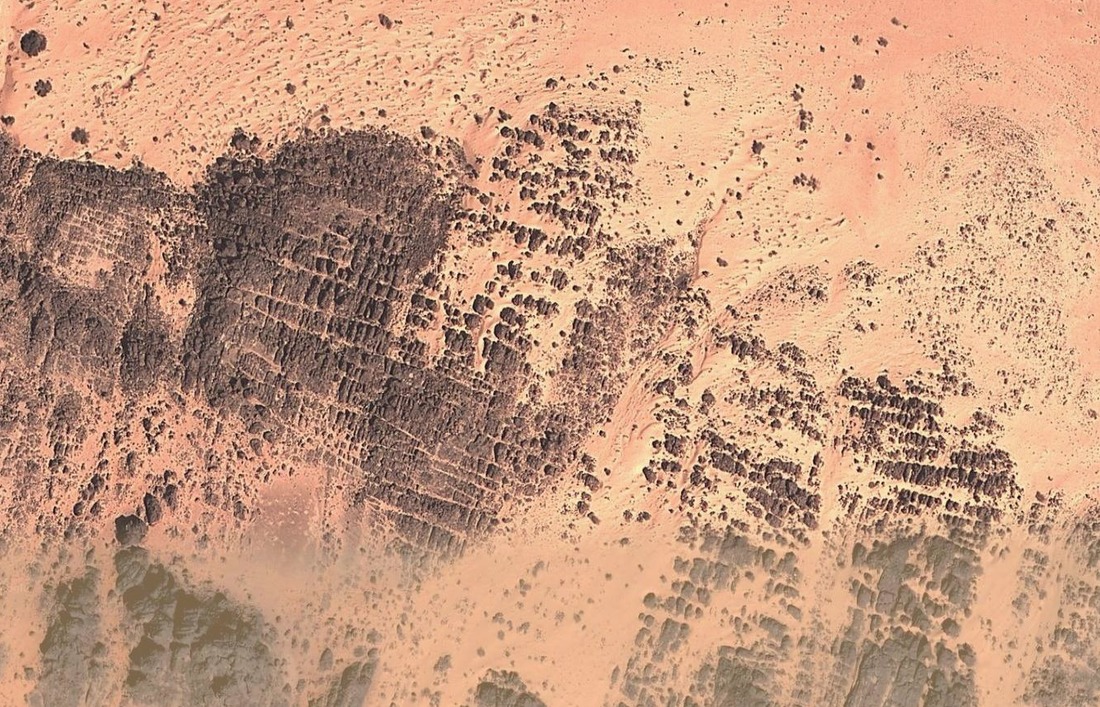
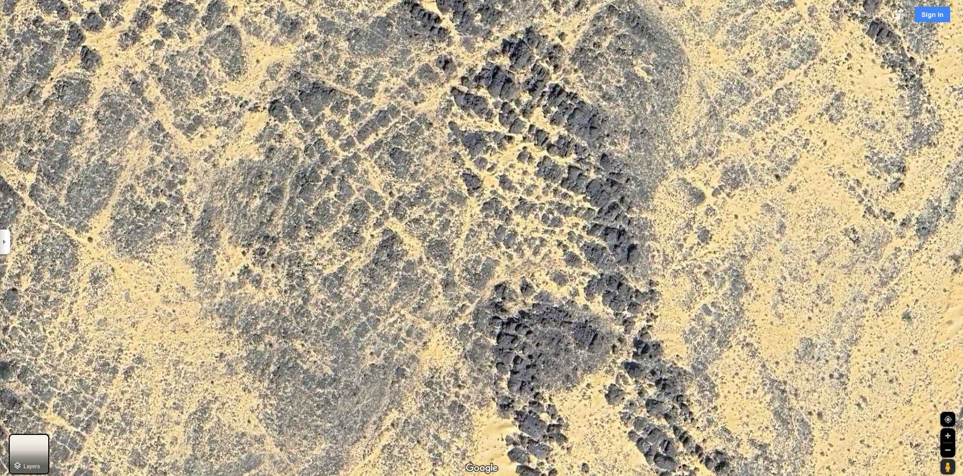
Cross-cut scarring in the Sahara. Image source: Google Maps
You are looking at scars left by machine quarrying. Rock has been removed from above these cuts. Click on the 'Image source' link to see each location in the web version of Google Maps.
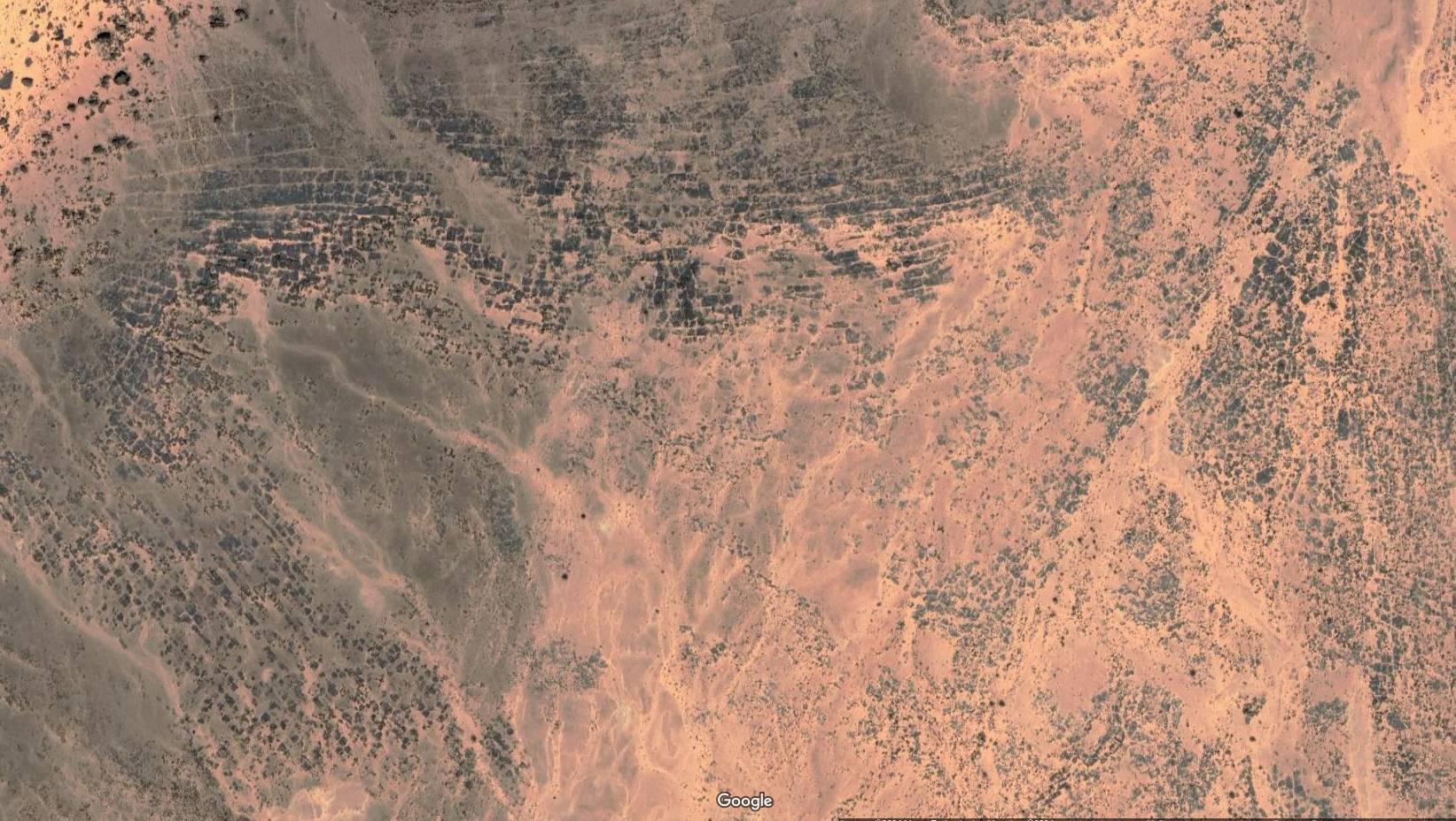
There are many, many more of these in this remote part of the Sahara:
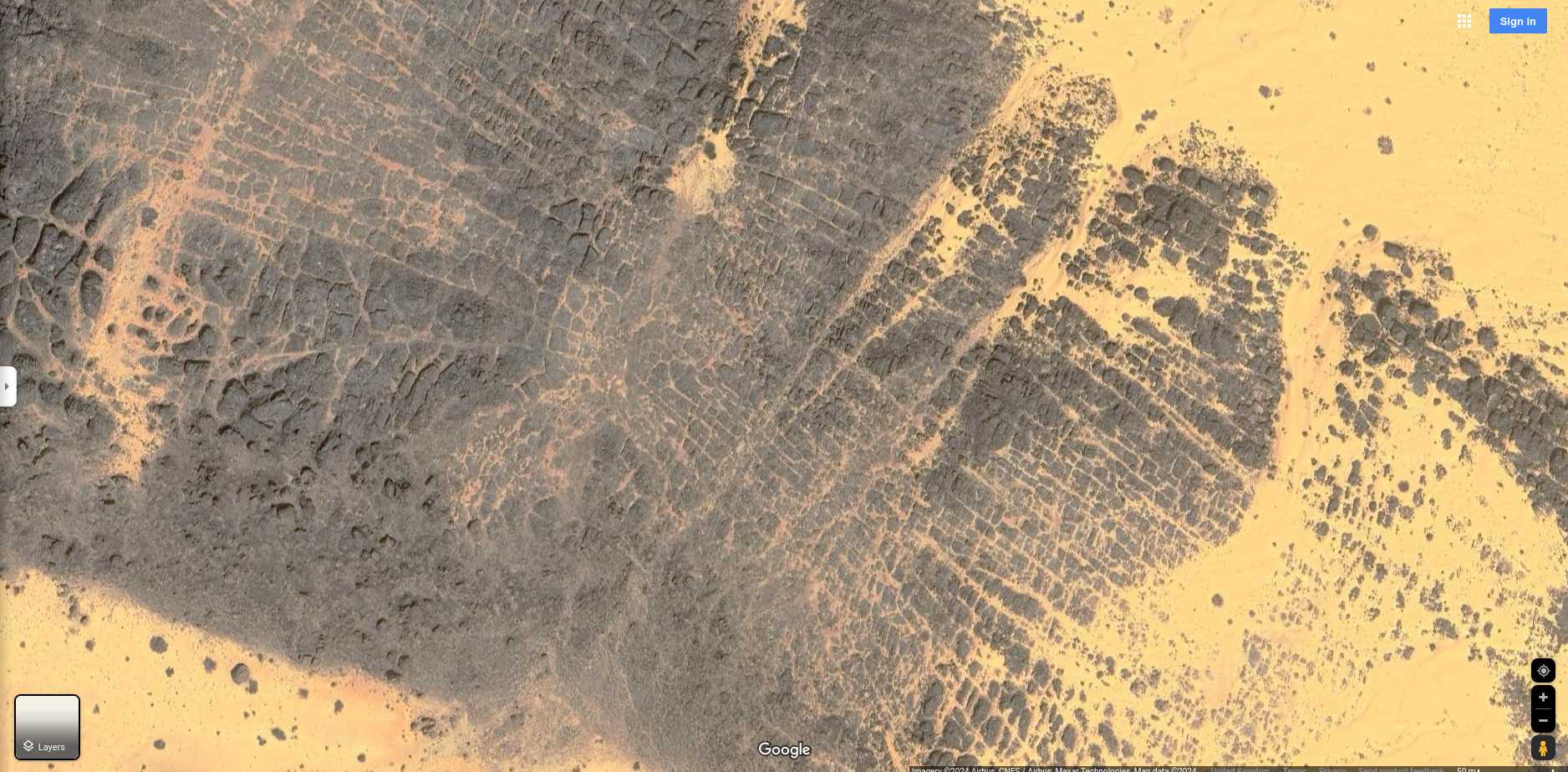
Image source: Google Maps
This image is of one small part of an extended area of cross-cut scarring. If the Sahara existed when this massif was quarried out then the sand and heat presented no challenge to the machinery and operators that removed such a large area of landscape. However, it seems more likely the Sahara was created partly by the destruction of what was here before and partly by the quarrying that removed some of the remaining rock.
Continuing:
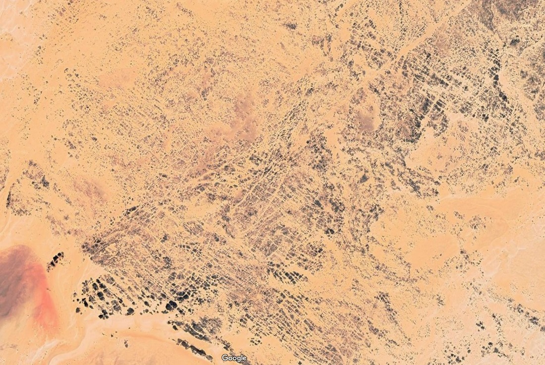
Image source: Google Maps
Note the number of linear features that seem to remain in and around the quarry scarring.
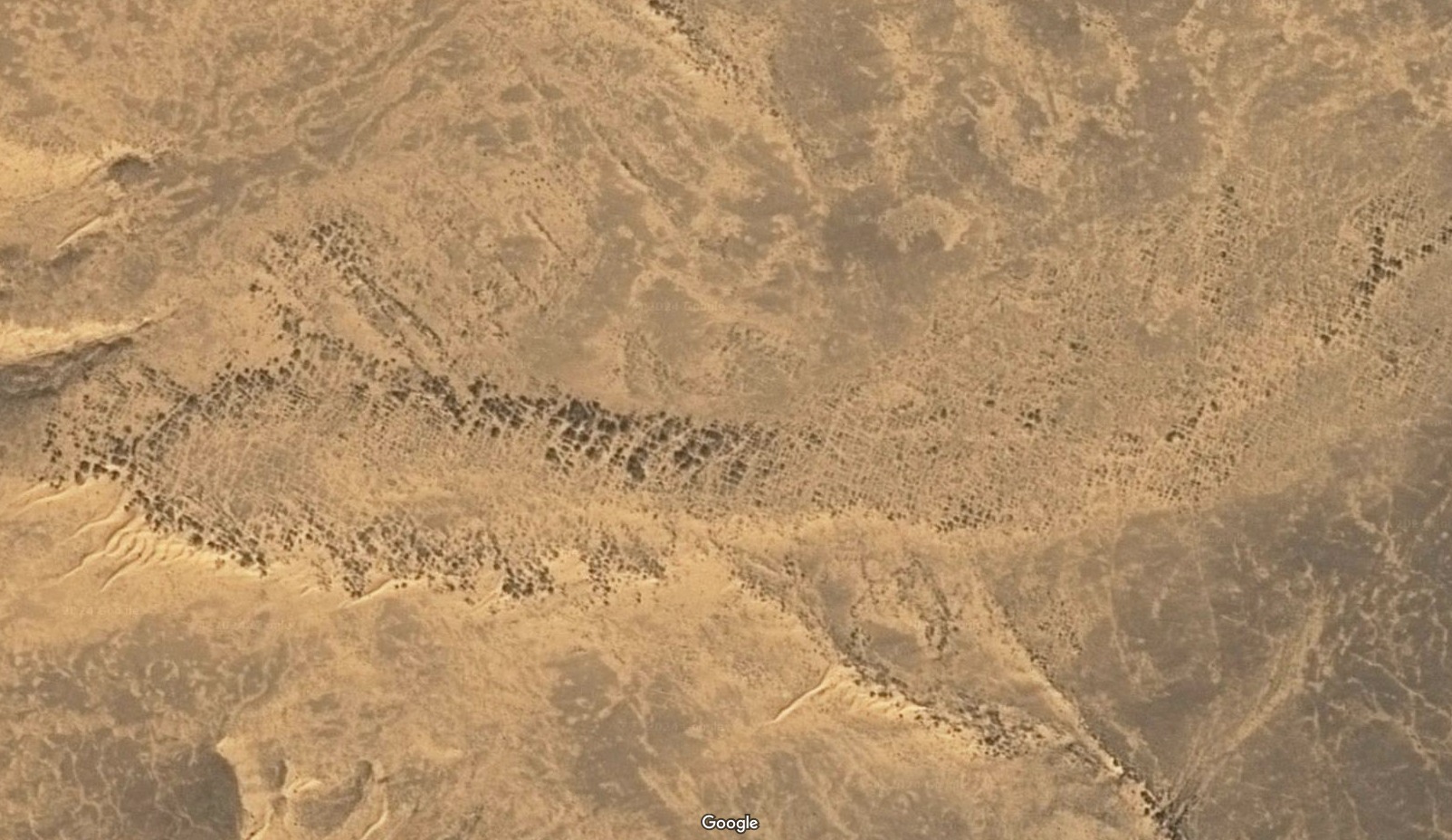
Image source: Google Maps
And click on the images to see a larger version:
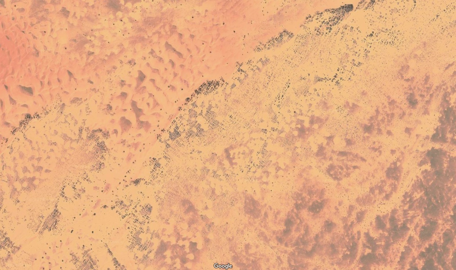
Image source: Google Maps
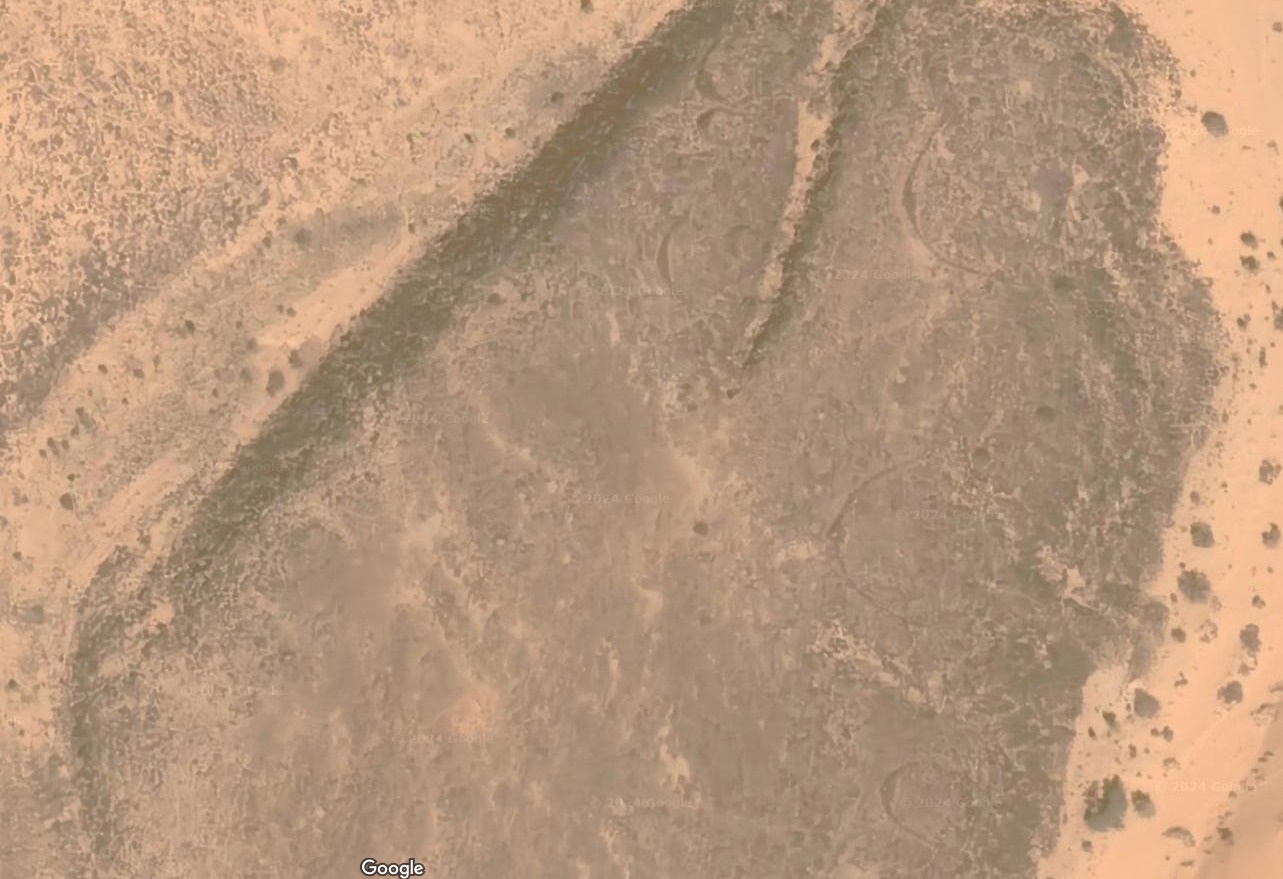
And:
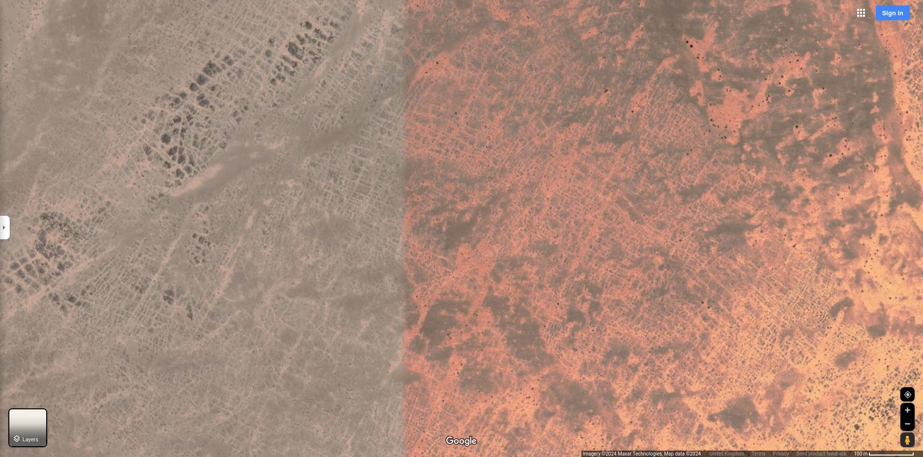
Image source: Google Maps
The dark shade to the left may be a Google artefact: a photo overlap. It helps outline the cross-cut remnants of quarrying.
Look for regularly striated rock. There are large areas of it west of Chinguetti:
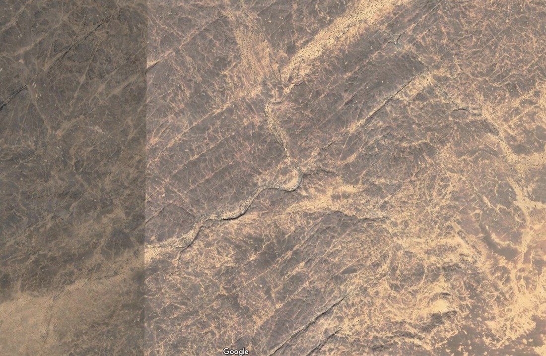
Image source: Google Maps
Again, the dark shade to the left may be a Google artefact: a photo overlap.
A map of these scars doesn't really help; you need to see photographic imagery. But if it helps put this scarring in context, here is each image location on a map, along with the west Sahara's most well-known craters:
West Saharan locations suggest evidence of quarry scarring.
Key:
- Blue marker: Evidence of quarrying scars
- Red marker: Craters
- Black marker: Chinguetti
Here are three more images from the same general area:
And:
And:
Give the right hand side a good look. What created the 'diamond ring' effects?
If volcanoes and meteorites did not create the polygon craters of Mauritania, what did?
These cross-cuts resemble the scars left when rock is sliced, then diced into columns, then the columns broken out for further processing. Broken out for onward shipment or for crushing for ore processing.
Crushing operations create gravel patches, which is probably why anomalous gravel patches are so often found near areas with cross-cuts. For example, the anomalous gravel patch beneath Crowland, near the Wash in England. And the anomalous gravel patches near the Wabar crater complex in Saudi Arabia.
In this context, Ourkziz Crater begins to resemble the remains of a leach pit - those gigantic basins dug out and used as pools for chemically separating valuable ores from crushed rocks.
It's doing the circle jerk. Source: RK 5000 bucket chain excavator - timelapse
The machine in this video could dig out Kemil Crater without changing position. Depending on the boom installed, it very nearly dig out Aouellel Crater without changing position.
By re-locating, it can dig out much bigger craters. It is big enough to have dug out several of the alleged meteorite craters in Africa.
Modern, larger excavators like the Bagger 288 and the Bagger 293 could dig out both craters out much more quickly.
And by moving sideways, any of these excavators could dig out arcs along a cliff line. Like the arcs north of Ourkziz Crater.
But quarrying machinery is not the whole explanation for "crateriform accidents". Especially for polygonal "crateriform accidents".
These strange structures can be more rationally explained as the result of two events interacting with various types of what Fudali and Cressy called "target terrains".
The next analysis compares how those "target terrains" looked before and after their "meteorite impact".
© All rights reserved. The original author/creator of each image, video, quote or text retains full ownership and rights.
![]() More of this investigation:
Desert Forensics,
More of this investigation:
Desert Forensics,
![]() More of this investigation:
The Reformation Was a Reformatting
More of this investigation:
The Reformation Was a Reformatting
![]() More by tag:
#geology, #enigmatic landscaping
More by tag:
#geology, #enigmatic landscaping