An unnatural coupling comes apart. Sat 31 January 2026
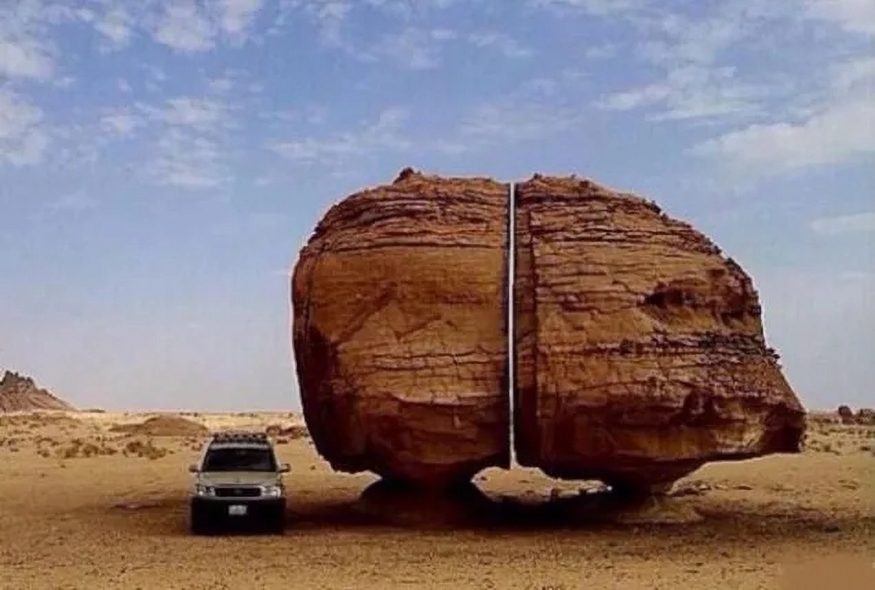
Saudi Arabia's perfectly natural Al Naslaa rock. Source: Al Naslaa Rock, Saudi Arabia
Geologists attribute Al Naslaa's eye-catching split to a weak joint.
Curiously, the split runs across Al Naslaa's horizontal sandstone layers.
The split should be horizontal, not vertical. Because weak joints should form between the rock layers, not across them.
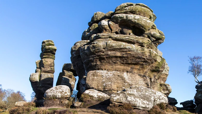
Al Naslaa should have weathered more like Brimham Rocks in Yorkshire:
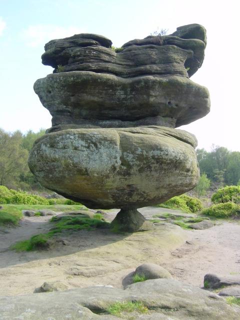
Though without the lichen. Source: Brimham Rocks - Wikipedia
This rock - Idol Rock - is a 4.5m high sandstone monolith whose narrow base and indented sides were eroded - we're told - by wind, rain and ice.
Al Naslaa is a 9m high sandstone twinolith whose narrow bases were eroded - we're told - by wind and sand.
But whose flat sides haven't apparently eroded much at all:
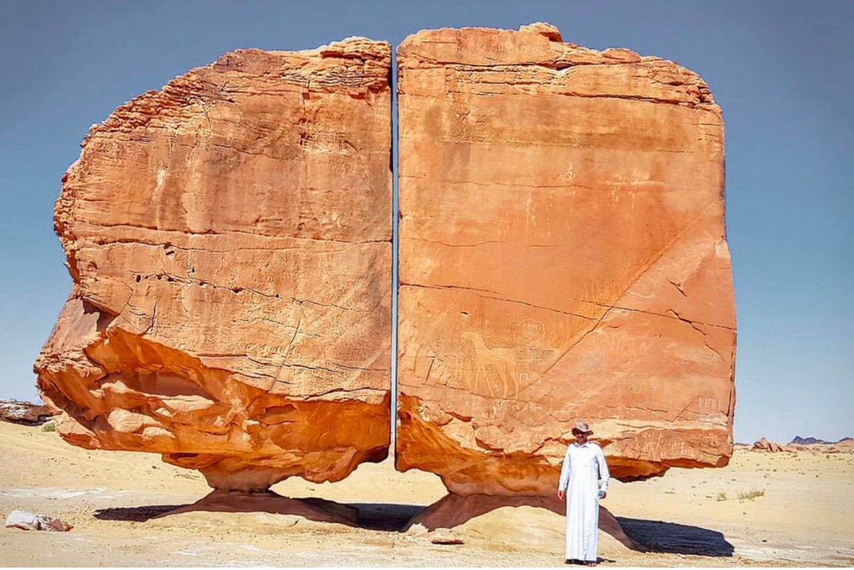
Despite being exposed to wind and sand. Source: The Al Naslaa rock an enigmatic sandstone block in Saudi Arabia perfectly split in two
This is the view from a little to the left:
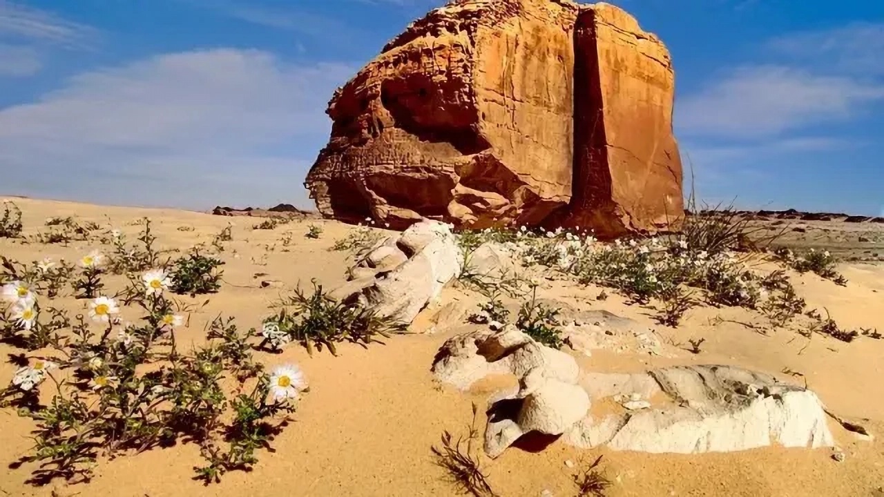
Source: Al Naslaa Rock, Saudi Arabia
These images of Al Naslaa are iconic. They've won photography awards.
Crucially though, they don't show the orientation of Al Naslaa's split or its two flat, exposed, rock faces:
They go this-away and that-away.
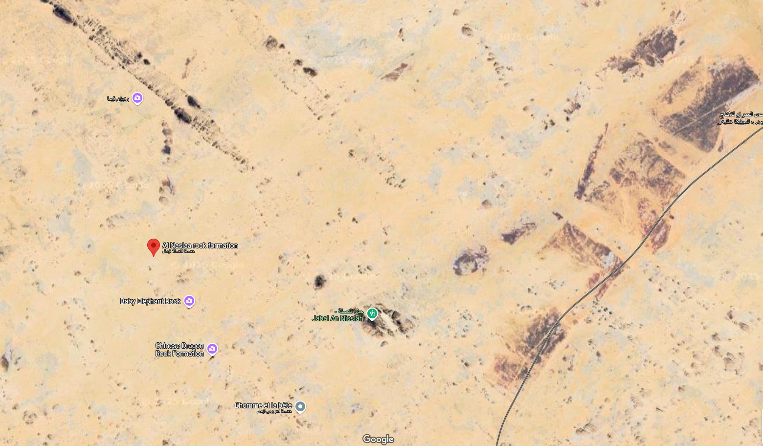
Key:
- Red marker: Al Naslaa
- Brown dashed line: Orientation of Al Naslaa's split
- Orange dashed lines: Orientation of Al Naslaa's two flat rock faces
And also crucially, Al Naslaa's most well-known images don't show the view from above:

And the shadows on the faces of its neighbours. Source: The Figen on X - the mystery behind Saudi Arabia’s Al Naslaa rock
From even further up, the shadows on the flat rock faces of its neighbours show up as thin, dark slivers:
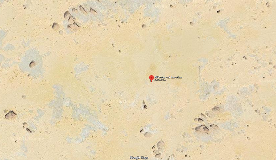
All aligned in the same direction. Source: Google Maps
Close up, their shadowed faces are easy to see:
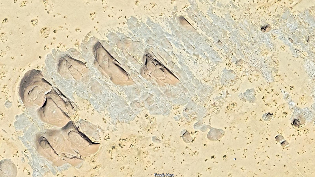
Along with the grey remains of their former neighbours. Source: Google Maps
This is the group of rocks in the top left of the first Google Maps image.
The shadows run parallel with Al Naslaa's split.
It is not obvious in this image but zoom in to the Google Maps link and you should see many of the flat rock faces continue across the desert bed as intermittent stony scars.
Like these:
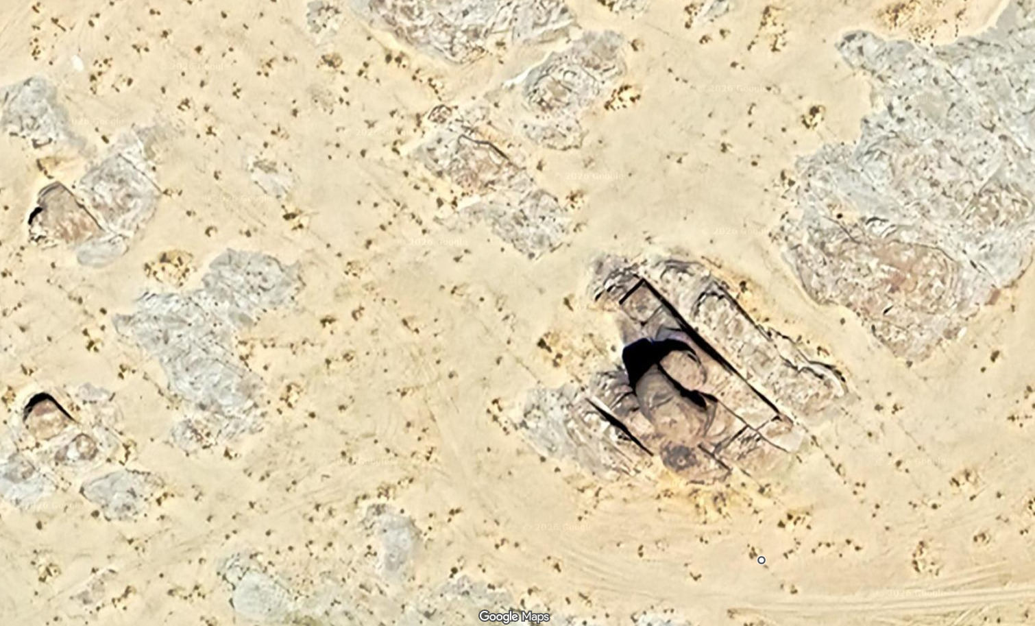
Source: Google Maps
Superimposed on the plan of Al Naslaa's flat faces, these lines look like this:
Orientation of ground scars around Al Naslaa
Key:
- Red marker: Al Naslaa
- Brown dashed line: Orientation of Al Naslaa's split
- Orange dashed line: Orientation of Al Naslaa's two flat rock faces
- Red lines: Direction of parallel cuts and scars visible on desert floor
This patch of red lines is merely illustrative. In reality, the lines cover a much larger area of desert than shown here.
In many places around Al Naslaa, more lines cross the parallel lines. These cross-cut lines are less obvious and harder to see.
But they are easy to see when they terminate within a rock outcrop:
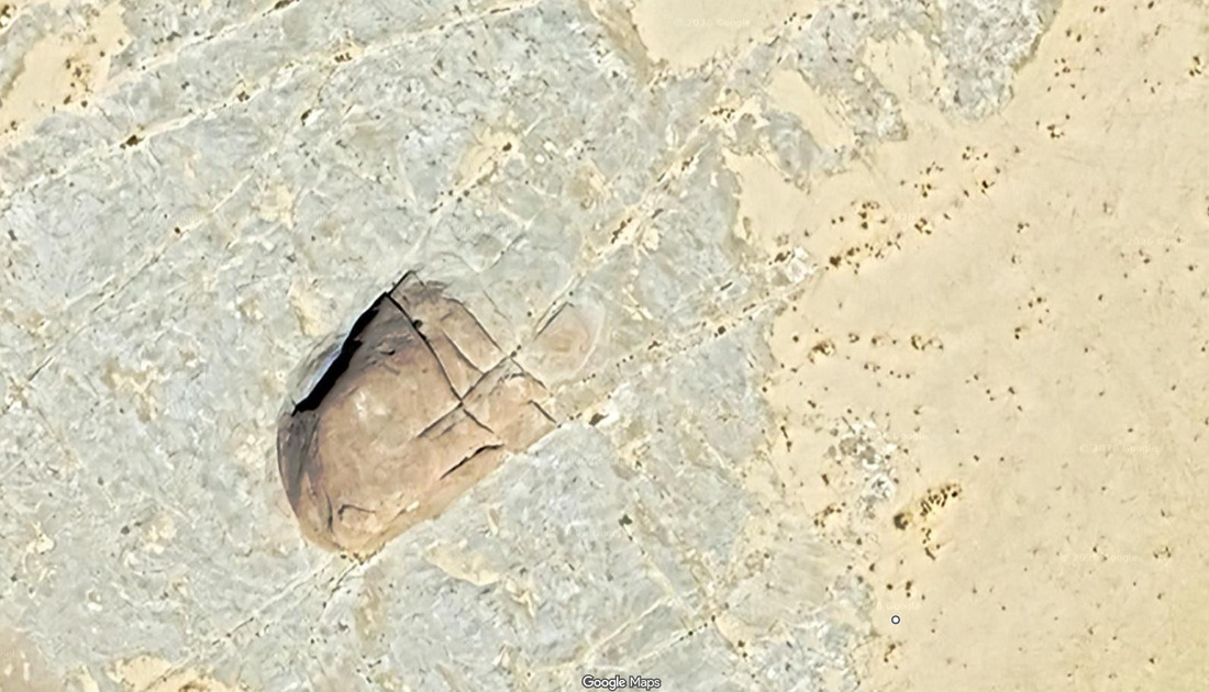
Source: Google Maps
They vary a bit but the cross-cut lines generally run south-west to north-east. They are roughly parallel with Al Naslaa's exposed flat faces.
Like this:
Al Naslaa's cross-cut environment
Key:
- Red marker: Al Naslaa
- Brown dashed line: Orientation of Al Naslaa's split
- Orange dashed line: Orientation of Al Naslaa's two flat rock faces
- Red lines: Direction of parallel cuts and scars visible on desert floor
- Blue lines: Direction of cross cuts visible on desert floor
Again, this patch of blue lines is merely illustrative. It shows you the orientation of the cross-cut lines. Like the red lines, they extend over a much larger area of desert than shown here.
This combination:
- Easy to see parallel lines
- criss-crossed by shorter, irregular lines
- accompanied by grey hints that rock has been removed
are signatures of macro-scale clean up.
Each of the clean up's stages leaves its own fingerprints.
The long parallel lines were likely cut first. The shorter, less regular, criss-cross lines were likely cut next. But not all in one go. They were likely cut in batches and the resulting columns of rock then sliced horizontally and removed. This is why the cross-cut lines are shorter and less regular. They signal slightly more intricate machine work.
Why this workflow?
Because if you don't remove the columns soon after cross-cutting, they are more likely to topple.
Like the one in the middle here:
Source: Visiting Brimham Rocks │ North East National Trust
Toppling columns slow down removal and can damage the machinery being used to cut and load around them. You may have to abandon an unstable column. And the rock it leans on.
Equally, you may leave them as clues, as Al Naslaa itself seems to have been.
Instead of being one, unique, split rock, Al Naslaa appears to be one big, photogenic, remnant of many squared off rocks. Rocks that were sliced, diced, and then - for the most part - removed.
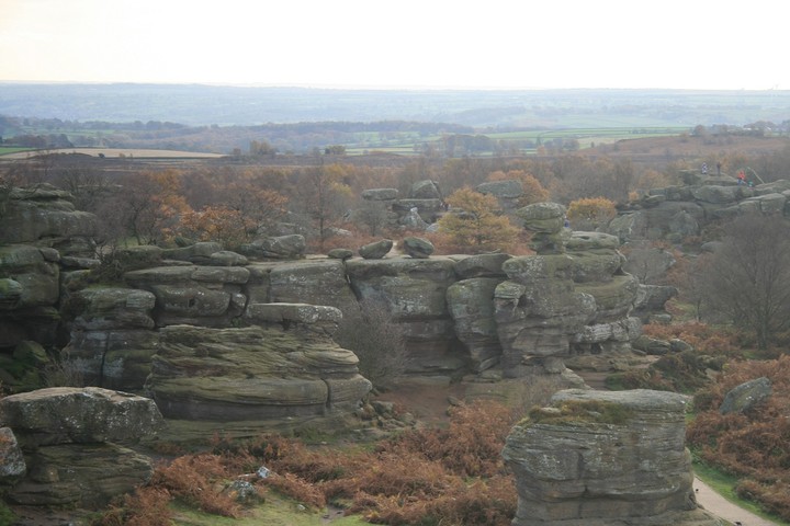
Just like the fragmented sandstone crags at Brimham Rocks:

Broken in the bracken: Brimham Rocks. Source: Google Maps
The flat faces of Idol Rock's neighbours at Brimham are easy to see - despite the weathering and the lichen, the bracken, and the trees now growing among them:
Source: Brimham Rocks (Rocky Outcrop) — The Modern Antiquarian
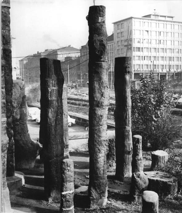
So are the corners left by cross cuts:
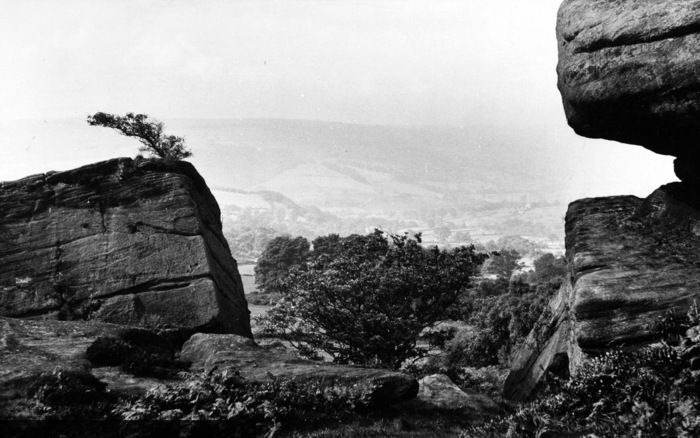
Brimham Rocks, 1960. Source: Photo Print of Brimham Rocks, General View c1960
Around Al Naslaa, some force seems to have burned large patches of sandstone black:
Black scars, cross-cuts and the grey remains of missing rock. Source: Google Maps
The green marker at lower centre identifies Jabal An Nisslah, a clump of rocks 2 km (1.5 miles) east of Al Naslaa.
Jabal An Nisslah also seems to have been blackened:
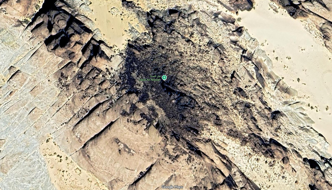
And sliced. Source: Google Maps
And perhaps even melted.
Many rocks in this area appear to have slumped or melted and are still partially blackened:
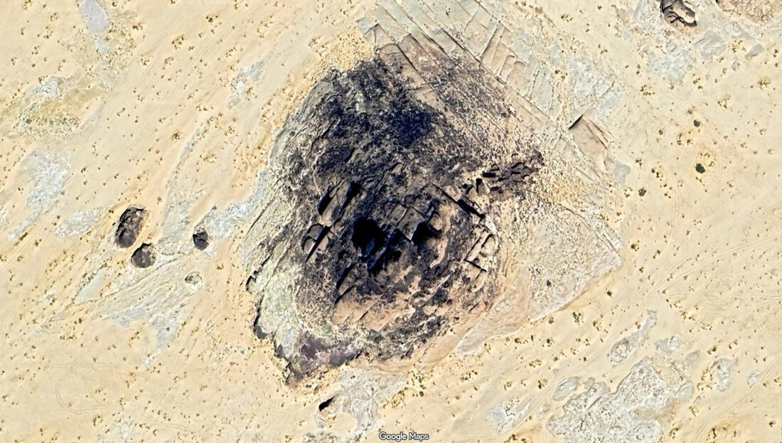
And sliced. And diced. Source: Google Maps
The area's combination of black patches, possible melting, cross-cuts, and traces of removed landscape hint at the same two-stage process familiar to readers of Desert Forensics - Part Four. Along with how they were probably created.
Around Brimham Rocks, the terrain is also blackened. But that's due to a recent wildfire. Layers of soil and vegetation hide any ground level traces of the forces that shaped the site's rocks.
But some evidence remains.
For example, Idol Rock used to have a neighbour:
Source: Brimham Craggs, Brimham Rocks, circa 1825 - Alamy
Its neighbour vanished some time around 1825.
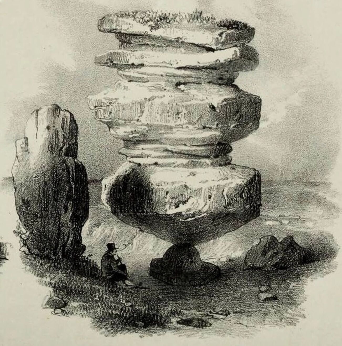
A print in the William Gott collection suggests that before 1825, its neighbour was being whittled down from something larger:
.JPG)
From Brimham Rocks by James Basire after Hayman Rooke, 1780s. Source: William Gott - Industrialist
Idol Rock's neighbour was not quite as close as Al Naslaa's two halves are today. They were separated by a gap wide enough for a man but too narrow for a camel.
Yet what the gap lacks in eye-catching narrowness, it makes up for in eye-catching curviness.
Some say the base of Idol Rock's missing neighbour looks a bit like a carved tree trunk.
Others say these are the mumblings of idiots.
Like the mumblings of the idiots who claim these rocks used to be trees:
Source: Chemnitz petrified forest - Wikipedia
And that this used to be a tree:
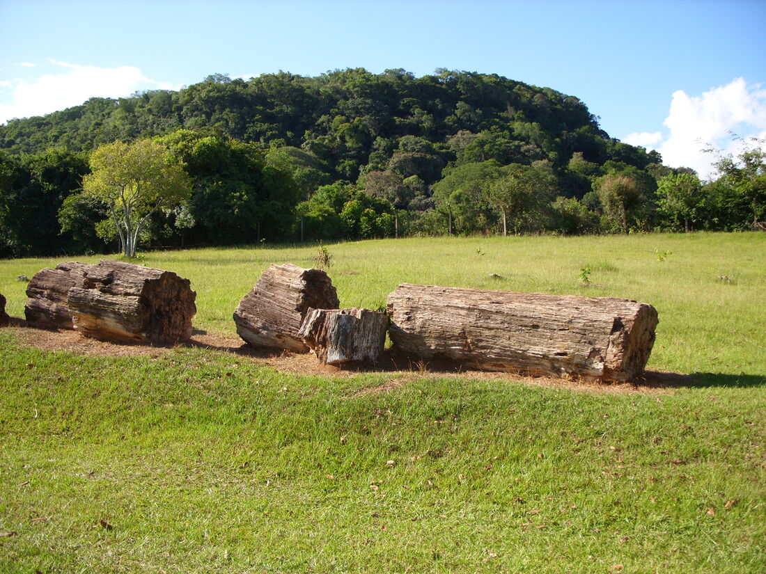
Segmented petrified log, Paleorrota geopark, Brazil. Source: Petrified wood - Wikipedia
And this:
Fossil tree, Puyango, Ecuador. Source: Petrified wood - Wikipedia
And this:

Segmented petrified log, Namibia Petrified Forest. Source: Petrified wood - Wikipedia
And this:
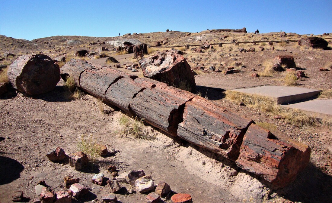
Segmented petrified tree. Source: Petrified Forest National Park - Wikipedia
And even this:
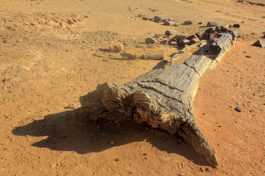
Petrified tree mineralised to quartz, Arizona. Source: The Lost Legacy
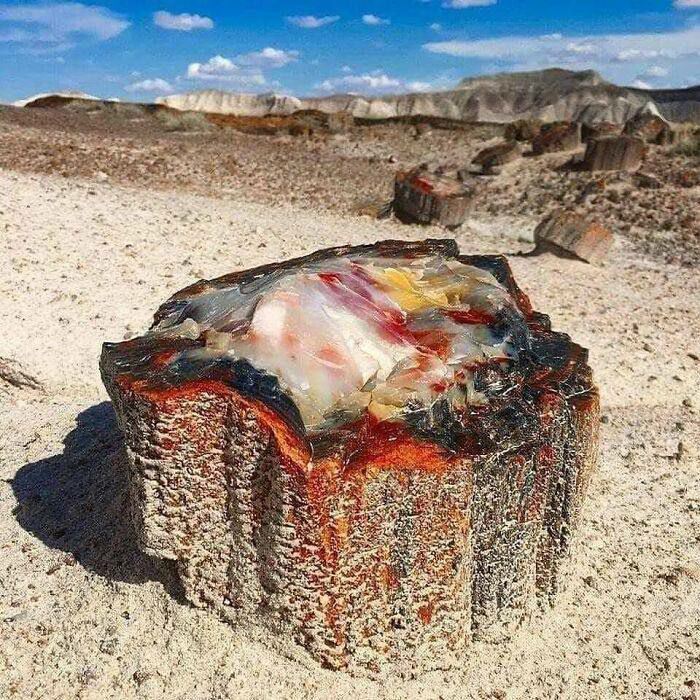
There are many, many petrified forests around the world. At least two are (barely) known in Saudi Arabia 1. And there are many, many lone, petrified trees 2.
Curiously, they often remain above ground level.
They hint that something seems capable of transforming timber into rock. Something that transforms the timber before it can rot away.
If that force was in action at Brimham Rocks, it would have presented quarrymen with a unique challenge:
Almost. Source: 7ft Dancing Ghost Made by Hand
© All rights reserved. The original author/creator of each image, video, quote or text retains full ownership and rights.
-
South of Layla and 40 km east of Al-Ajalaiyah Centre, another north of Riyadh, another near Sakaka and Arar in north west Saudi Arabia, and another on El Hedda mountain between Taif and Mecca in western Saudi Arabia. ↩
-
Petrified wood is silicon dioxide AKA quartz. Some petrified tree trunks are agate AKA "fibrous quartz". Conceivably, some sand may even be petrified saw dust. Sandstone is quartz cemented together by clay, calcite or more quartz. Red sandstone is (primarily) quartz grains cemented together by iron oxide (rust). Chemically, it's as if their locations were flooded with some version of sodium silicate solution AKA waterglass, though there may be other explanations. ↩
![]() More of this investigation:
Desert Forensics,
More of this investigation:
Desert Forensics,
![]() More of this investigation:
The Reformation Was a Reformatting,
More of this investigation:
The Reformation Was a Reformatting,
![]() More of this investigation:
Fingerprints of the Clean Up Team,
More of this investigation:
Fingerprints of the Clean Up Team,
![]() More of this investigation:
How Do You Get A.I. to Think for Itself?
More of this investigation:
How Do You Get A.I. to Think for Itself?
![]() More by tag:
#enigmatic landscaping
More by tag:
#enigmatic landscaping